

Meet Live Earth, the Cloud-Based Platform That Combines, Correlates and Visualizes Any Real-Time Data Stream on an Interactive Map
The Big Data Problem: Multiple, Isolated Systems That Don’t Communicate
Many organizations have invested considerable money and time into Big Data systems: video surveillance, vehicle location, sensor networks, access control, IoT devices and others. Yet those systems:
- Are isolated, requiring extra personnel to monitor, manage and analyze the data
- Can take days or weeks to extract insight
- Do not intercommunicate or cross-reference information
The Live Earth Solution: Combine, Correlate, Visualize
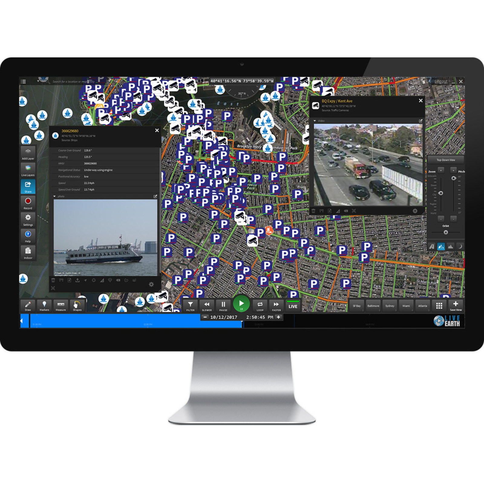
Live Earth changes all that. You can integrate all your existing systems, sensors and devices in minutes with our easy-to-use configuration wizard. Live Earth then displays all your information on an interactive map with live monitoring and playback capabilities. Add in other data sources like traffic, weather and parking information, and you have seamless access to a holistic information ecosystem. This means faster response times and higher quality insights. And it’s all in real-time.
Also Read: First-Of-Its-Kind Subscription Streaming Service, INDISTRY TV, Announces Beta Launch
Put the Data to Work: Multi-Feed Alerts
Live Earth also allows you to create alerts based on inter-feed conditions. For example:
- Vehicle location
- Vehicle condition sensors
- Weather alerts
- Traffic conditions
You can view individual vehicle details: locations, cargo manifest, load weight, fuel level and estimated range. You can also set up alerts for changes in traffic flow or accidents, as well as weather alerts in relation to that vehicle. This allows logistics centers to guide their fleets around traffic congestion and prepare for adverse weather to optimize drive time and increase fleet efficiency.
Analytics Tools
Live Earth has a built-in suite of analytics tools. The timeline is interactive, so you can move time back and forth to view all your information as it was three minutes ago, three days ago or three months ago. You can create geofences and alerts for specific activities in that location. You can track and trace assets and measure distance. And if you need to share your findings, Live Earth lets you take a screenshot, record a video of the screen, and export an interactive scene, viewable by anyone with a web browser.
Recommended Read: Data Intelligence Company Thasos Brings Much Needed Transparency to Retail Foot Traffic in Its Report

